Safer, Faster Commercial Roof Assessments by Drone
Drone roof inspection delivers faster, safer, and more detailed assessments than traditional methods — no ladders, no climbers, no liability exposure from personnel accessing rooftops. For property managers, insurance adjusters, and roofing contractors, drones eliminate fall risks while providing better documentation than walking inspections can deliver.
Our certified pilots capture high-resolution visual and thermal imagery of commercial rooftops, giving you the data you need for insurance claims, preventive maintenance planning, and damage assessment after storms or other events. Whether you’re managing a single building or a portfolio of commercial properties, drone inspections reduce costs, accelerate timelines, and improve decision quality.
What We Deliver
Orthomosaic roof maps creating full overhead composite imagery of the entire roof surface. Orthomosaics provide uniform coverage and accurate measurements, supporting roof area calculations, material quantity estimates, and detailed damage documentation for insurance claims.
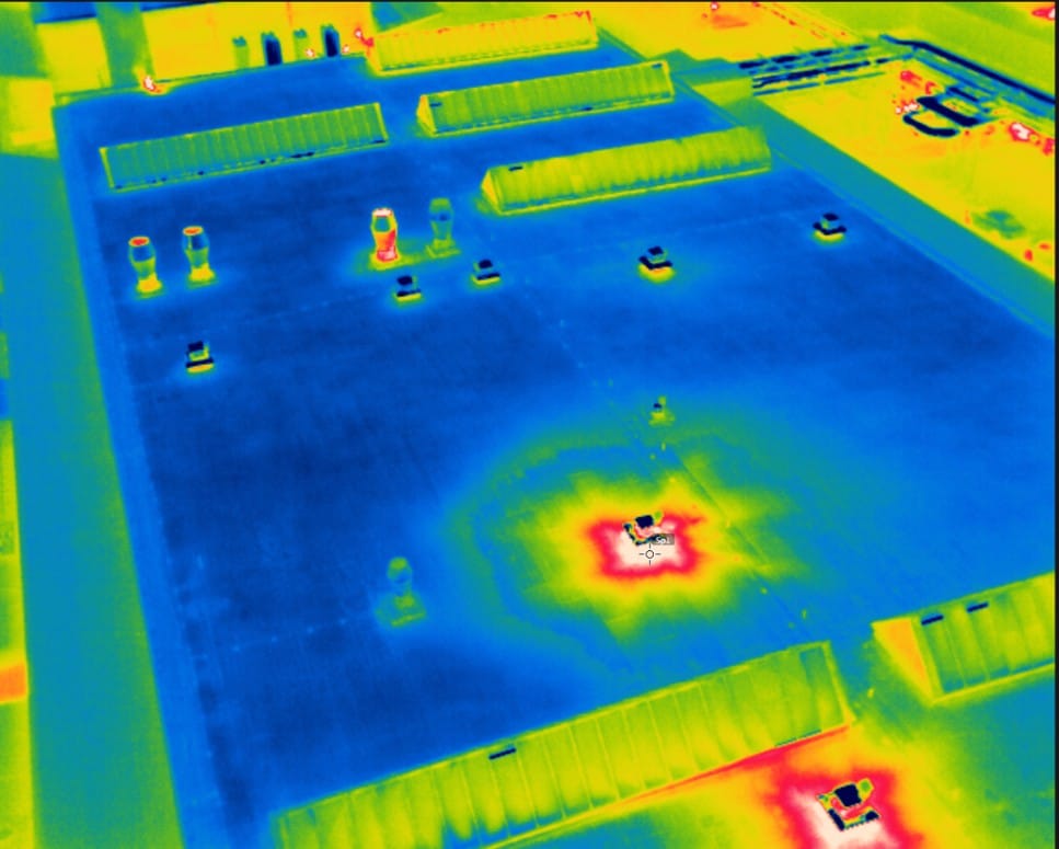
Thermal imaging to detect moisture intrusion, heat loss, and insulation gaps using calibrated infrared cameras that reveal temperature differentials invisible to visual inspection. Wet insulation shows up as cool spots where evaporative cooling occurs. Missing or damaged insulation appears as warm areas where conditioned air escapes. Early detection prevents small leaks from becoming major problems.
Damage identification including hail impacts, wind damage, ponding water, membrane deterioration, flashing failures, and fastener back-out. We document conditions with annotated imagery showing damage location, extent, and severity — critical information for repair scoping and insurance claim substantiation.
Detailed inspection reports with annotated imagery, organized by roof section and damage type. Reports include measurements, severity classifications, and recommended actions based on observed conditions. For insurance claims, documentation meets adjuster requirements for claim processing.
Why Roofing Professionals Choose Drones
Traditional roof inspections require accessing the roof surface — climbing ladders, navigating parapets, and walking across membranes that may be damaged, slippery, or structurally compromised. The safety risks are real. Falls from commercial buildings result in serious injuries and fatalities every year.
Liability concerns compound the risk. Property owners face exposure when contractors or adjusters access rooftops on their property. Insurance carriers worry about adjuster safety. Roofing contractors factor fall protection and safety training costs into every bid.
Drone roof inspection eliminates these concerns. Pilots operate from the ground, capturing complete roof coverage without anyone accessing the roof surface. Fall risk disappears. Liability exposure from rooftop access vanishes. The inspection happens faster too — what takes an hour to walk and document manually takes minutes with a drone.
The data quality is superior. Thermal imaging reveals subsurface moisture that walking inspections miss entirely. Orthomosaic maps provide comprehensive coverage — traditional inspections document sample areas and extrapolate conditions across the roof. Drones capture every square foot.
Timing flexibility matters for insurance work. After major hail or wind events, adjusters face backlogs of claims requiring roof assessment. Deploying drones accelerates the process, completing inspections in minutes instead of the hour-plus traditional methods require. More claims processed per day means faster settlements and better customer service.
Ideal For
Property managers and building owners responsible for maintaining commercial buildings, needing periodic roof condition assessments to budget capital improvements and prioritize preventive maintenance.
Insurance adjusters and claims teams documenting damage after storms, assessing claim validity, and quantifying loss for settlement purposes. Drone documentation provides objective evidence supporting claim decisions.
Roofing contractors scoping repair jobs, measuring roof areas, identifying damage extent, and developing accurate material quantity estimates before bidding projects. Better data leads to more accurate bids and fewer change orders.
Post-storm damage documentation for property owners filing insurance claims or property managers assessing portfolio-wide damage after hail, wind, or other weather events affecting multiple buildings.
Our Approach
Our pilots follow documented safety protocols on every flight, coordinating with property managers to ensure safe operations around building occupants and nearby traffic. We’re fully insured with coverage appropriate for commercial property work, FAA Part 107 certified, and equipped with thermal cameras and high-resolution visual sensors designed for building inspection applications.
Flights happen quickly with minimal disruption to building operations. We coordinate timing to avoid conflicts with tenant activities and schedule thermal imaging during optimal conditions when temperature differentials reveal moisture issues most clearly.
Deliverables include visual orthomosaics, thermal imagery, annotated damage maps, and detailed inspection reports. For insurance claims, we provide documentation formatted to meet adjuster requirements. For maintenance planning, reports include severity classifications and recommended action timelines.
The business case is straightforward. Eliminating rooftop access eliminates fall risk and associated liability. Thermal imaging detects problems early when repairs are minor instead of waiting for leaks to cause interior damage. Accurate measurements reduce material waste and change orders. For most applications, the ROI is immediate — faster, safer, and more accurate than the alternatives.
Explore our other inspection services: cell tower inspections, utility inspections, solar panel inspections, wind turbine inspections, and agricultural drone services.
Deliverables support claims documentation per ITEL and insurance carrier requirements. All pilots hold FAA Part 107 certification.
High-Resolution Blade Inspections Without Rope Access
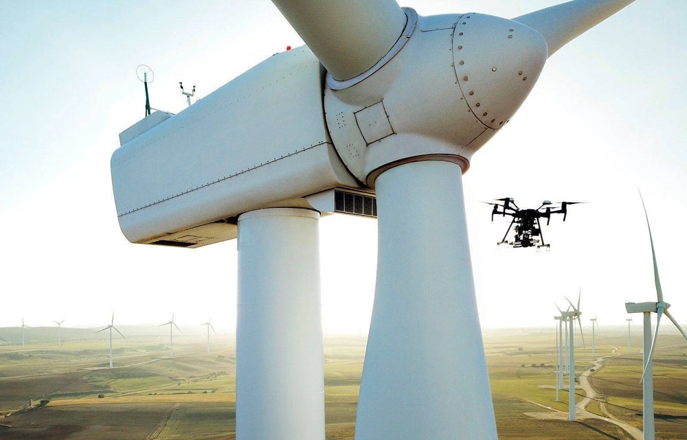
Wind turbine blade inspections are critical for maintaining performance and extending asset life. Traditional methods require rope access teams or expensive crane setups — slow, risky, and costly. Drone wind turbine inspection captures high-resolution imagery of every blade surface from multiple angles, delivering the detail you need to assess damage and plan maintenance without taking turbines offline for extended periods.
For wind farm operators managing dozens or hundreds of turbines, the cost and scheduling complexity of traditional blade inspections create real operational challenges. Rope access requires specialized technicians, favorable weather windows, and turbine downtime that directly reduces revenue. Drone inspections eliminate these constraints while improving data quality and worker safety.
What We Deliver
High-resolution visual inspection of all blade surfaces, capturing leading edges, trailing edges, pressure sides, and suction sides from root to tip. Our imagery resolution reveals damage as small as individual gel coat cracks, providing the detail engineers need to assess structural integrity and plan repairs.
Leading edge erosion detection, documenting the progressive wear that reduces aerodynamic efficiency and cuts annual energy production. We map erosion severity across the blade span, supporting decisions about leading edge protection application or blade replacement timing.
Lightning strike and crack identification, locating impact damage, delamination, and structural cracks that compromise blade strength. Early detection prevents catastrophic failures and allows repairs during planned maintenance windows instead of emergency shutdowns.
Structured inspection reports with annotated imagery, organized by turbine and blade position. Each finding includes severity classification, GPS coordinates, and distance-from-tip measurements so maintenance crews can locate damage quickly. Reports document conditions for warranty claims, insurance assessments, and regulatory compliance.
Comparison data for tracking degradation over time, showing how damage progresses between inspection cycles. Understanding degradation rates helps optimize inspection frequency and maintenance scheduling, balancing inspection costs against failure risk.
Why Wind Farms Are Moving to Drones
Rope access inspection has been the wind industry standard, but the method has serious drawbacks. Technicians rappel down spinning towers or work from platforms while turbines are shut down, documenting damage with handheld cameras. The work is dangerous — fall protection is critical, and weather constraints limit inspection windows to calm conditions.
The process is slow too. Inspecting a three-blade turbine takes hours per unit. For a 100-turbine farm, that’s weeks of work coordinating technician schedules, managing turbine shutdowns, and waiting for suitable weather. Lost production during shutdowns compounds the cost.
Drone wind turbine inspection solves these problems. A single pilot can inspect multiple turbines per day, capturing complete blade coverage in a fraction of the time rope access requires. Turbines remain stopped during the inspection but for minutes instead of hours, minimizing production loss.
The data quality often exceeds rope access results. Drones capture consistent imagery from repeatable positions, making year-over-year comparison straightforward. Automated flight paths ensure complete coverage of all blade surfaces with no gaps. Image resolution reveals small cracks and erosion damage that technicians at arm’s length might miss.
Safety improvements are substantial. Eliminating rope access eliminates fall risk. Pilots operate from the ground in controlled conditions, removing personnel from hazardous at-height work environments entirely.
Ideal For
Wind farm operators and asset managers maintaining fleets of turbines across single or multiple sites, requiring regular inspection cycles to meet manufacturer warranty requirements and operational performance targets.
O&M service providers delivering contracted inspection and maintenance services for wind farm owners, needing rapid deployment capabilities and standardized reporting formats.
Insurance and warranty inspections, documenting damage for claims or verifying that blade conditions meet manufacturer warranty terms before expiration.
Pre-acquisition due diligence, assessing blade condition as part of wind farm purchase evaluations to quantify deferred maintenance liabilities and inform valuation.
Our Approach
Every inspection follows a standardized flight protocol ensuring consistent coverage and repeatable results. We document all blade surfaces from multiple angles, capturing overlap between images that supports detailed damage mapping. Flight altitude and camera settings are optimized for the resolution needed to detect early-stage damage.
Pilots are fully insured, FAA Part 107 certified, and experienced in wind turbine inspection operations. We understand the operational environment — coordination with site management for turbine shutdowns, adherence to site safety protocols, and recognition of damage types that require immediate attention versus routine maintenance.
Deliverables include high-resolution imagery organized by turbine and blade, annotated inspection reports with severity classifications, and georeferenced damage maps. If you’re tracking blade condition over time, we provide side-by-side comparisons showing damage progression between inspection cycles.
The economics favor drones. Eliminating rope access reduces inspection costs while improving safety. Faster inspections mean less lost production. Better data supports more informed maintenance decisions, reducing emergency repairs and extending component life. For most operations, the ROI is clear within the first inspection cycle.
Explore our other inspection services: cell tower inspections, utility inspections, solar panel inspections, roof inspections, and agricultural drone services.
Our inspection protocols align with ASTM E2841 standards for wind turbine condition assessment. All pilots hold FAA Part 107 certification.
Thermal and Visual Solar Array Inspections by Drone
Underperforming solar panels cost you money every day they go undetected. Drone solar panel inspection identifies issues across an entire array in a fraction of the time it takes to inspect on foot, using calibrated thermal imaging that reveals problems invisible to visual inspection alone.
Our pilots fly calibrated thermal and RGB sensors over your solar installation, capturing the data needed to pinpoint hotspots, cell defects, and connection failures — all without shutting down production. For utility-scale solar farms spanning hundreds of acres and commercial rooftop arrays covering tens of thousands of square feet, manual inspection methods simply can’t compete with the speed and coverage drones provide.
What We Deliver
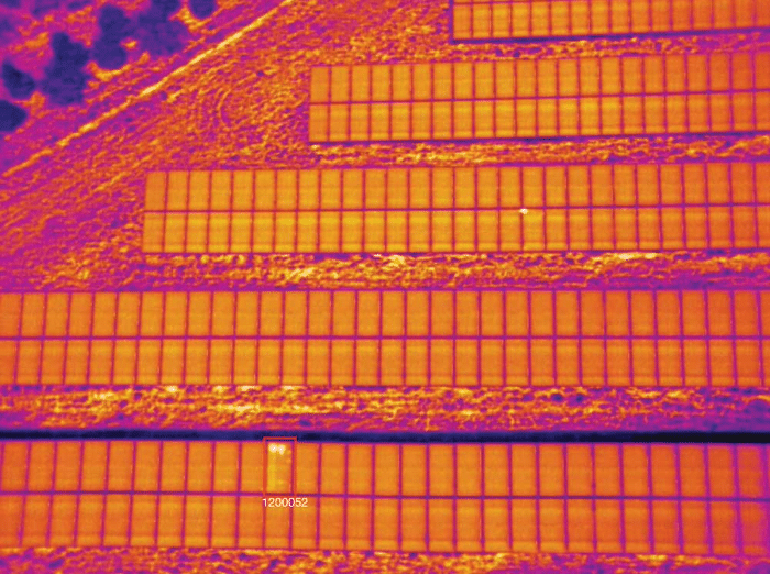
Thermal imaging to detect hotspots, diode failures, and cell damage using radiometric thermal cameras that capture precise temperature measurements across every panel in your array. Failing cells and bypass diode issues appear as temperature anomalies — we identify them, classify severity, and provide GPS coordinates so your maintenance crews can locate problems immediately.
Visual inspection for cracked panels, soiling, and physical damage, documenting surface defects, bird damage, hail impacts, and other conditions that reduce output or create long-term reliability concerns. High-resolution RGB imagery captures details down to individual cell level.
Full-array orthomosaic maps with GPS-tagged anomalies, creating a complete visual and thermal record of your installation. Orthomosaics provide uniform coverage across the entire site, eliminating gaps and ensuring no section goes uninspected.
Detailed reports with severity classification and recommended actions. We categorize findings by impact level — critical failures requiring immediate attention, moderate issues to address during scheduled maintenance, and minor defects to monitor over time. Reports include thermal imagery, visible-light photos, and location data for every identified anomaly.
Why Solar Operators Choose Drone Inspections
Traditional solar inspection methods involve walking arrays with handheld thermal cameras or relying on string-level monitoring that identifies underperforming circuits without pinpointing specific failed panels. Both approaches are slow and incomplete.
Walking a large solar farm takes days or weeks. Inspectors cover a fraction of the array per day, and conditions change during the inspection period — what you measured on day one may not reflect current state by the time you finish day ten. Drones complete the same inspection in hours, capturing the entire array under consistent conditions.
String monitoring identifies underperformance but doesn’t tell you which panel failed or why. You know a problem exists somewhere in a string of twenty panels, but you still need to physically locate the failure. Drone solar panel inspection eliminates the guesswork — thermal imaging shows exactly which panel is failing and what type of failure it is.
The data quality is superior too. Drone-mounted thermal cameras capture consistent, calibrated measurements across the entire array from optimal angles, revealing temperature differentials that ground-based inspections miss. Automated flight paths ensure complete coverage with overlap, so nothing falls through the cracks.
Inspections happen without production interruption. Arrays remain energized and generating revenue while we fly. That continuity matters for sites operating under power purchase agreements where every megawatt-hour counts.
Ideal For
Solar farm operators and asset managers responsible for maintaining uptime and maximizing energy production across utility-scale installations.
EPC contractors conducting commissioning inspections to verify installation quality before handoff, and warranty inspections documenting defects covered under equipment or installation guarantees.
Insurance assessments following hail storms, high winds, or other weather events that may have damaged arrays — quantifying loss and supporting claims with documented evidence.
Residential and commercial portfolio managers maintaining distributed solar assets across multiple properties, needing periodic condition assessments to prioritize maintenance budgets and plan component replacements.
Our Approach
Inspections are completed quickly with minimal disruption. We coordinate flight timing to match optimal thermal conditions — typically mid-morning to early afternoon when panels are under load and temperature differentials are most pronounced. Flights happen during active generation, so there’s no lost production.
Our pilots are fully insured, FAA Part 107 certified, and equipped with radiometric thermal cameras that capture absolute temperature measurements — not just relative thermal images. Radiometric data provides quantitative analysis, showing exact temperature differentials that support engineering assessments and warranty claims.
Deliverables include thermal orthomosaics, RGB orthomosaics, georeferenced anomaly maps, and detailed inspection reports. If you’re tracking array degradation over time, we provide comparison analysis showing how conditions changed between inspection cycles. Data exports to common solar asset management platforms, or we deliver raw imagery and thermal data files for your own analysis workflows.
The economics are compelling. Identifying and replacing a few dozen underperforming panels can increase annual production by thousands of kilowatt-hours. A single inspection pays for itself in recovered generation within months.
Explore our other inspection services: cell tower inspections, utility inspections, wind turbine inspections, roof inspections, and agricultural drone services.
Inspections follow IEC 62446-3 standards for outdoor IR thermography of PV systems. All pilots hold FAA Part 107 certification.
Actionable Crop Intelligence from the Air
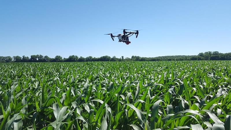
Making decisions about your fields shouldn’t rely on guesswork. Drone crop monitoring gives you field-level data throughout the growing season — so you can act on what’s actually happening, not what you think is happening. For farmers and agronomists managing thousands of acres, walking fields to scout problem areas is time-consuming and often reveals issues too late to fully mitigate. Aerial crop monitoring changes that equation.
Our pilots capture multispectral and high-resolution RGB imagery that maps crop health, identifies stress areas, and highlights drainage or emergence issues before they become expensive problems. The data we deliver integrates with your existing farm management software, providing prescription-ready maps for variable rate applications and targeted interventions.
What We Deliver
NDVI and crop health maps across your full acreage, showing crop vigor and stress patterns invisible from ground level. Multispectral sensors capture near-infrared reflectance that correlates directly with chlorophyll content and plant health. Problem areas stand out clearly, allowing you to deploy resources where they’ll have the most impact.
Stand count and emergence analysis during critical early-season growth stages. Identifying poor emergence zones within days of planting lets you make replant decisions before it’s too late, or adjust inputs to compensate for population variability across the field.
Drainage issue identification and tile line mapping using elevation data and moisture stress patterns. Persistent wet spots show up clearly in multispectral imagery, helping you target tile repairs or drainage improvements to the areas that need them most.
Weed pressure and pest damage detection, mapping infestations so you can apply herbicides or insecticides only where needed instead of blanket-treating entire fields. Variable rate application reduces chemical costs while improving efficacy.
Prescription-ready data compatible with major farm management platforms including Climate FieldView, John Deere Operations Center, and Trimble Ag Software. Our deliverables export directly to application controllers for variable rate seeding, fertilization, and chemical application.
Why Aerial Monitoring Beats Ground Scouting
Ground scouting has been the industry standard for decades, but it’s inherently limited. Walking a 500-acre field means sampling a tiny fraction of the total area and extrapolating results. Problems hiding between your scouting routes go undetected until they’re large enough to spot from the edge.
Drone crop monitoring covers every acre in a single flight, creating a complete picture of field conditions. Stress patterns emerge clearly when you see the whole field at once — areas you’d never have scouted on foot become obvious. That complete coverage matters during critical growth stages when days count.
The data is quantitative too. Instead of subjective assessments of crop health, you get normalized difference vegetation index (NDVI) values, stand count estimates, and thermal data showing water stress. Those numbers support better decisions and create a historical record you can analyze across growing seasons to understand yield variability and refine management zones.
Timing flexibility is another advantage. Our pilots deploy when you need data — not when a scouting schedule says it’s time for a walk-through. Suspected disease outbreak? Hail damage after a storm? Uneven emergence after planting? We can fly within 24-48 hours and deliver results the same day.
Ideal For
Farmers and agronomists managing large acreage where ground scouting becomes impractical and field variability demands site-specific management strategies.
Crop consultants providing advisory services to multiple growers, needing objective data to support recommendations on inputs, replant decisions, and harvest timing.
Seed companies running trial plots, requiring precise stand counts, uniformity assessments, and performance documentation across varieties and treatments.
Insurance adjusters assessing crop damage from hail, wind, drought, or flooding — quantifying loss across entire fields instead of relying on sample areas.
Our Approach
We’ve scanned over a million acres and understand the ag calendar. Our pilots know that corn emergence monitoring needs to happen within a narrow window, that late-season soybean scans help time fungicide applications, and that post-hail imagery is time-sensitive for insurance claims.
Equipment matters too. We fly calibrated multispectral sensors designed for agricultural applications — not consumer drones with RGB cameras. Our sensors capture the spectral bands that matter for crop health assessment, and we process imagery using validated vegetation indices that correlate with peer-reviewed research.
Deliverables are practical. You get georeferenced NDVI maps, annotated RGB imagery highlighting problem areas, and prescription files ready for upload to your application equipment. If you need raw imagery or specialized analysis, we provide that too. The goal is giving you data you can act on today, not reports that sit on a shelf.
We’re equipped, experienced, and ready to deploy when timing matters most. Spring emergence, mid-season scouting, or pre-harvest assessments — we coordinate flight timing around your schedule and deliver results fast enough to inform same-week decisions.
Explore our other inspection services: cell tower inspections, utility inspections, solar panel inspections, wind turbine inspections, and roof inspections.
Our NDVI and multispectral data integrates with platforms like John Deere Operations Center and Climate FieldView. All pilots hold FAA Part 107 certification.
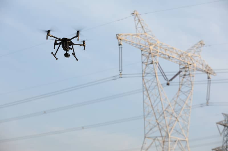
Drone-Based Utility Inspections That Reduce Risk and Downtime
Utility infrastructure inspections are high-stakes — aging assets, hard-to-reach locations, and tight regulatory timelines. Drone utility inspection lets you inspect more infrastructure in less time, with better data and without putting crews in hazardous positions. For electric utilities managing thousands of miles of transmission corridors and hundreds of substations, drones eliminate the need for bucket trucks, helicopter patrols, and live-line climbing on energized equipment.
Our pilots have completed over 10,000 utility inspections across power lines, substations, transmission towers, and distribution networks. We know what your engineering teams need and deliver it in a format they can use — whether that’s thermal anomaly reports for predictive maintenance programs or high-resolution imagery for vegetation management planning.
What We Deliver
Power line and transmission corridor patrols covering overhead conductors, insulators, crossarms, and support structures. We document condition across entire circuits, identifying damaged hardware, worn components, and potential failure points before they cause outages.
Substation and switchyard visual inspections that eliminate the need for scaffolding, boom lifts, or energized equipment access. Our pilots capture detailed imagery of transformers, breakers, disconnect switches, and bus work from safe standoff distances, allowing engineers to assess equipment condition without de-energizing facilities.
Vegetation encroachment and right-of-way surveys using high-resolution imagery and LiDAR when clearance measurements are required. We document tree growth, danger tree candidates, and vegetation that threatens minimum clearance distances, providing actionable data for trimming crews and contractors.
Thermal imaging of connections, transformers, and insulators using calibrated radiometric cameras that detect temperature differentials indicating loose connections, overloaded circuits, and failing components. Early detection prevents catastrophic failures and unplanned outages.
Pole and structure condition assessments, documenting woodpecker damage, rot, rust, foundation issues, and other structural degradation that compromises system reliability.
LiDAR-compatible deliverables when your project requires precise measurements, terrain modeling, or integration with GIS systems for line design and clearance analysis.
Why Utilities Are Adopting Drones
Traditional utility inspection methods rely on manual patrols, helicopter flights, and bucket truck access — each with limitations. Ground patrols miss details visible only from elevated positions. Helicopter inspections are expensive and weather-dependent. Bucket trucks require road access and extended crew time at each structure.
Drone utility inspection solves these problems. A single pilot can inspect miles of transmission corridor in a day, capturing consistent, high-resolution data at a fraction of the cost of helicopter patrols. Thermal imaging reveals problems invisible to the naked eye, enabling predictive maintenance strategies that prevent failures instead of reacting to them.
For substations and switchyards, drones eliminate the need to de-energize equipment or deploy personnel near live electrical infrastructure. Inspections happen faster, with less operational disruption, and without the arc flash and electrocution risks inherent in manual inspections of energized equipment.
Regulatory compliance is simpler too. NERC standards require vegetation management and equipment inspection on defined cycles. Drones accelerate these inspections while creating timestamped, geotagged documentation that supports compliance audits and regulatory filings.
Ideal For
Electric utilities and cooperatives managing transmission and distribution infrastructure across service territories spanning hundreds or thousands of square miles.
Transmission and distribution operators conducting routine inspection cycles, storm damage assessments, and post-maintenance verification.
Vegetation management teams identifying trim priorities, danger trees, and right-of-way encroachments that threaten service reliability and regulatory compliance.
Engineering and inspection firms providing contracted inspection services for utilities, requiring rapid deployment capabilities and deliverables compatible with client asset management systems.
Our Approach
Every flight follows utility-specific safety protocols including NERC compliance awareness, minimum approach distances for energized equipment, and coordination with system operators when inspecting substations or critical infrastructure. Our pilots understand the operational environment — they know to avoid inducing outages, coordinate with dispatch during inspections near critical loads, and recognize the difference between routine wear and conditions requiring immediate attention.
We’re fully insured with coverage limits appropriate for utility infrastructure work, maintain FAA Part 107 certifications, and have pilots experienced in utility corridor operations who understand transmission line construction, substation equipment, and the regulatory environment utilities operate within.
Deliverables include georeferenced imagery, thermal anomaly reports with temperature data, and annotated findings reports organized by severity. If you’re tracking asset condition over time, we provide comparison reports showing degradation trends across inspection cycles. The data integrates with common utility asset management platforms, or we deliver raw imagery and metadata for your internal analysis workflows.
Explore our other inspection services: cell tower inspections, solar panel inspections, wind turbine inspections, roof inspections, and agricultural drone services.
Operations follow NERC reliability standards awareness protocols and all pilots hold FAA Part 107 certification.
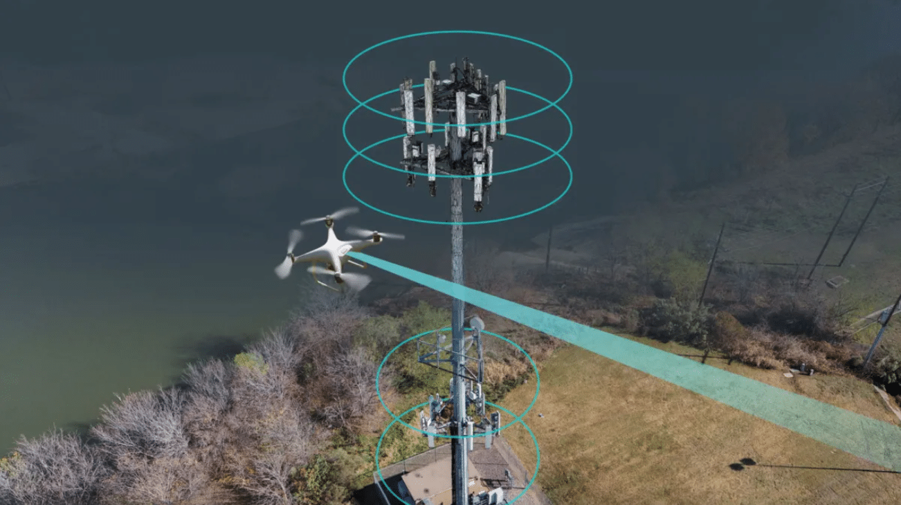
Telecom Site Surveys and Infrastructure Inspections
Climbing towers for routine inspections is slow, expensive, and puts people at risk. Drone cell tower inspection delivers the same data — often better — in a fraction of the time, without a single climber on the structure. For wireless carriers, towercos, and telecom engineering firms managing thousands of sites, eliminating rope access and bucket truck deployments translates to significant cost savings and zero fall-risk incidents.
Our pilots inspect cell towers, small cells, rooftop installations, and telecom infrastructure across the country. We capture the imagery and data your engineering teams need for maintenance planning, lease audits, and new site evaluation. Every inspection follows FAA Part 107 regulations and site-specific safety protocols, coordinating with ground crews and facility managers to ensure operational continuity.
What We Deliver
Full 360° tower inspections covering macro sites, small cells, and rooftop installations from ground level to the top-mounted antenna arrays. Our flight paths capture every structural element, mount point, and equipment configuration, creating a complete visual record of site conditions.
Antenna and equipment identification and mapping using high-resolution imagery and GPS tagging. We document antenna orientations, azimuths, downtilt settings, and equipment model numbers — data your RF engineering teams need for network optimization and upgrade planning.
Mount and structural condition assessments that identify rust, loose bolts, damaged welds, guy wire wear, and other structural concerns before they escalate. We flag issues by severity level, allowing you to prioritize maintenance budgets and schedule repairs during planned outages.
Line-of-sight analysis for new site planning, capturing elevation data and obstruction surveys that support propagation modeling and network densification projects. Our deliverables integrate directly into RF planning software.
Closeout photography and as-built documentation for new construction and modification projects, providing verification that installations match approved drawings and meet carrier specifications.
Obstruction surveys and FAA compliance checks, documenting lighting systems, paint condition, and other regulatory requirements to support renewal filings and lease compliance audits.
Why Drones Replace Traditional Tower Climbing
The telecom industry has relied on tower climbers for decades, but the human and financial costs are steep. Fall incidents remain a persistent safety concern, and climbing inspections require significant scheduling coordination, weather-dependent windows, and extended site access periods.
Drone cell tower inspection eliminates these constraints. A typical macro site inspection that would take a three-person crew half a day to climb and document can be completed by a single drone pilot in under an hour. That efficiency compounds across large tower portfolios — inspecting 100 sites per year becomes a weeks-long project instead of a months-long campaign.
The data quality often exceeds traditional methods. Drones capture consistent, high-resolution imagery from repeatable positions, making year-over-year degradation tracking more reliable. Close-up shots of individual components reveal details that climbers at arm’s length might miss.
Ideal For
Wireless carriers and towercos managing distributed infrastructure across multiple markets, requiring regular inspection cycles to maintain network uptime and meet insurance requirements.
Telecom engineering firms providing design, construction oversight, and commissioning services for new builds and major modifications.
Site acquisition and leasing teams conducting pre-lease evaluations, documenting existing conditions for lease negotiations, and verifying that site modifications comply with landlord agreements.
Construction and closeout verification, ensuring contractors completed work to specification before releasing final payments or triggering warranty periods.
Our Approach
We’ve cut inspection time by up to 70% compared to traditional tower climbs while improving data consistency and eliminating fall risk exposure. Our pilots carry full commercial liability insurance, maintain FAA Part 107 certifications, and have direct telecom site experience — they understand the difference between a remote radio head and a hybrid cable, and they know what your engineers need to see in the deliverables.
Flight planning accounts for site-specific conditions: proximity to airports requiring LAANC authorization, RF exposure zones near active antenna arrays, and coordination with on-site personnel during active construction. Deliverables are organized by inspection type and delivered in formats compatible with your existing asset management systems.
Every inspection includes a detailed flight log, georeferenced imagery, and annotated reports highlighting findings that require follow-up. If you need raw imagery for your own analysis, we provide that too. The goal is simple: give your team the data they need, in the format they need, without the safety risks and time commitments of traditional inspection methods.
Explore our other inspection services: utility inspections, solar panel inspections, wind turbine inspections, roof inspections, and agricultural drone services.
All pilots maintain current FAA Part 107 certification and coordinate airspace authorization through LAANC when required.
