
Actionable Crop Intelligence from the Air
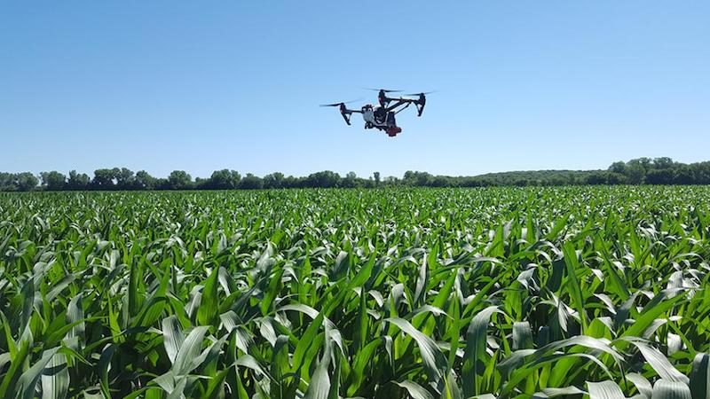
Making decisions about your fields shouldn’t rely on guesswork. Drone crop monitoring gives you field-level data throughout the growing season — so you can act on what’s actually happening, not what you think is happening. For farmers and agronomists managing thousands of acres, walking fields to scout problem areas is time-consuming and often reveals issues too late to fully mitigate. Aerial crop monitoring changes that equation.
Our pilots capture multispectral and high-resolution RGB imagery that maps crop health, identifies stress areas, and highlights drainage or emergence issues before they become expensive problems. The data we deliver integrates with your existing farm management software, providing prescription-ready maps for variable rate applications and targeted interventions.
What We Deliver
NDVI and crop health maps across your full acreage, showing crop vigor and stress patterns invisible from ground level. Multispectral sensors capture near-infrared reflectance that correlates directly with chlorophyll content and plant health. Problem areas stand out clearly, allowing you to deploy resources where they’ll have the most impact.
Stand count and emergence analysis during critical early-season growth stages. Identifying poor emergence zones within days of planting lets you make replant decisions before it’s too late, or adjust inputs to compensate for population variability across the field.
Drainage issue identification and tile line mapping using elevation data and moisture stress patterns. Persistent wet spots show up clearly in multispectral imagery, helping you target tile repairs or drainage improvements to the areas that need them most.
Weed pressure and pest damage detection, mapping infestations so you can apply herbicides or insecticides only where needed instead of blanket-treating entire fields. Variable rate application reduces chemical costs while improving efficacy.
Prescription-ready data compatible with major farm management platforms including Climate FieldView, John Deere Operations Center, and Trimble Ag Software. Our deliverables export directly to application controllers for variable rate seeding, fertilization, and chemical application.
Why Aerial Monitoring Beats Ground Scouting
Ground scouting has been the industry standard for decades, but it’s inherently limited. Walking a 500-acre field means sampling a tiny fraction of the total area and extrapolating results. Problems hiding between your scouting routes go undetected until they’re large enough to spot from the edge.
Drone crop monitoring covers every acre in a single flight, creating a complete picture of field conditions. Stress patterns emerge clearly when you see the whole field at once — areas you’d never have scouted on foot become obvious. That complete coverage matters during critical growth stages when days count.
The data is quantitative too. Instead of subjective assessments of crop health, you get normalized difference vegetation index (NDVI) values, stand count estimates, and thermal data showing water stress. Those numbers support better decisions and create a historical record you can analyze across growing seasons to understand yield variability and refine management zones.
Timing flexibility is another advantage. Our pilots deploy when you need data — not when a scouting schedule says it’s time for a walk-through. Suspected disease outbreak? Hail damage after a storm? Uneven emergence after planting? We can fly within 24-48 hours and deliver results the same day.
Ideal For
Farmers and agronomists managing large acreage where ground scouting becomes impractical and field variability demands site-specific management strategies.
Crop consultants providing advisory services to multiple growers, needing objective data to support recommendations on inputs, replant decisions, and harvest timing.
Seed companies running trial plots, requiring precise stand counts, uniformity assessments, and performance documentation across varieties and treatments.
Insurance adjusters assessing crop damage from hail, wind, drought, or flooding — quantifying loss across entire fields instead of relying on sample areas.
Our Approach
We’ve scanned over a million acres and understand the ag calendar. Our pilots know that corn emergence monitoring needs to happen within a narrow window, that late-season soybean scans help time fungicide applications, and that post-hail imagery is time-sensitive for insurance claims.
Equipment matters too. We fly calibrated multispectral sensors designed for agricultural applications — not consumer drones with RGB cameras. Our sensors capture the spectral bands that matter for crop health assessment, and we process imagery using validated vegetation indices that correlate with peer-reviewed research.
Deliverables are practical. You get georeferenced NDVI maps, annotated RGB imagery highlighting problem areas, and prescription files ready for upload to your application equipment. If you need raw imagery or specialized analysis, we provide that too. The goal is giving you data you can act on today, not reports that sit on a shelf.
We’re equipped, experienced, and ready to deploy when timing matters most. Spring emergence, mid-season scouting, or pre-harvest assessments — we coordinate flight timing around your schedule and deliver results fast enough to inform same-week decisions.
Explore our other inspection services: cell tower inspections, utility inspections, solar panel inspections, wind turbine inspections, and roof inspections.
Our NDVI and multispectral data integrates with platforms like John Deere Operations Center and Climate FieldView. All pilots hold FAA Part 107 certification.