Most companies do not struggle because they lack photos of their assets. They struggle because the photos are scattered, inconsistent, hard to compare, and disconnected from the decisions that need to be made.
That problem shows up everywhere: telecom teams managing towers and compounds, construction teams tracking site conditions, facilities managers reviewing roofs and building envelopes, solar operators looking for performance issues, agriculture teams scouting fields, and infrastructure owners trying to prioritize maintenance. The assets are different, but the core question is the same: what changed, how serious is it, and what should we do next?
A one-time drone flight can answer part of that question. A repeatable drone inspection program answers it much better.
Instead of treating aerial imaging as a one-off event, commercial teams can use recurring drone inspections to create a practical record of asset condition over time. The result is not just better imagery. It is better visibility, better documentation, and better decisions.
What Is a Drone Inspection Program?
A drone inspection program is a structured approach to capturing, organizing, and using aerial data across one asset, multiple sites, or an entire portfolio.
That structure matters. A basic flight can produce useful photos. A program defines what gets captured, how often, from what angles, at what resolution, under what operating conditions, and how the results are delivered.
For a commercial buyer, that usually means:
- Defined inspection goals
- Standard flight plans or capture requirements
- Consistent image naming and location reference
- Repeatable deliverables
- Clear issue documentation
- A schedule tied to business needs
- A process for comparing current conditions to prior data
The goal is to make sure the people responsible for maintenance, operations, construction, or capital planning have reliable information when they need it.
Why One-Off Inspections Only Go So Far
One-time drone inspections are useful. They can document storm damage, inspect a roof before repair work, capture a telecom site before an upgrade, or provide current aerial imagery before construction starts.
The limitation is context.
If a team only has one inspection, it can see what exists today. It may not know whether a crack is new, whether vegetation is spreading, whether roof wear is accelerating, whether a tower compound has changed, or whether a contractor’s work matches the previous phase.
Recurring inspections create a timeline. That timeline turns static imagery into operational intelligence.
That comparison is difficult when every inspection is handled differently. It becomes much easier when the data is captured consistently.
Where Drone Inspection Programs Create Business Value
The strongest drone programs are built around buyer value, not novelty. The drone is only useful because it changes the cost, speed, safety, or quality of inspection work.
Faster Site Visibility
Commercial teams often make decisions with incomplete field information. A drone inspection can document large areas, hard-to-reach assets, rooftops, towers, fields, corridors, and construction sites faster than manual inspection alone.
Safer Data Collection
Some inspection work puts people in risky positions: climbing towers, walking steep roofs, navigating active job sites, entering difficult terrain, or working near energized equipment.
Drones do not eliminate every inspection need, and they do not replace qualified specialists. But they can reduce the amount of time people spend in hazardous areas by collecting high-resolution visual data from a safer position. Use drones first, then send people only where hands-on work is actually needed.
Better Documentation
Phone photos are useful in the moment, but they often create problems later. They may lack location context, consistent framing, or clear organization. A month later, no one is quite sure which photo came from which section, row, tower face, roof area, or work zone.
A drone inspection program can standardize capture and delivery so teams know what they are looking at. That can include georeferenced imagery, annotated reports, orthomosaics, photo logs, thermal data where appropriate, and issue summaries tied to specific locations.
Better documentation supports maintenance planning, insurance coordination, owner reporting, contractor accountability, and internal decision-making.
More Useful Comparisons Over Time
The real value of recurring inspections often appears after the second or third flight.
When imagery is captured in a similar way each time, teams can compare conditions with confidence. They can see whether an issue is stable, worsening, repaired, or newly introduced.
Common Use Cases for Commercial Drone Inspection Programs
Aero Deploy works across several practical drone service categories. The exact deliverables change by asset type, but the program mindset applies across all of them.
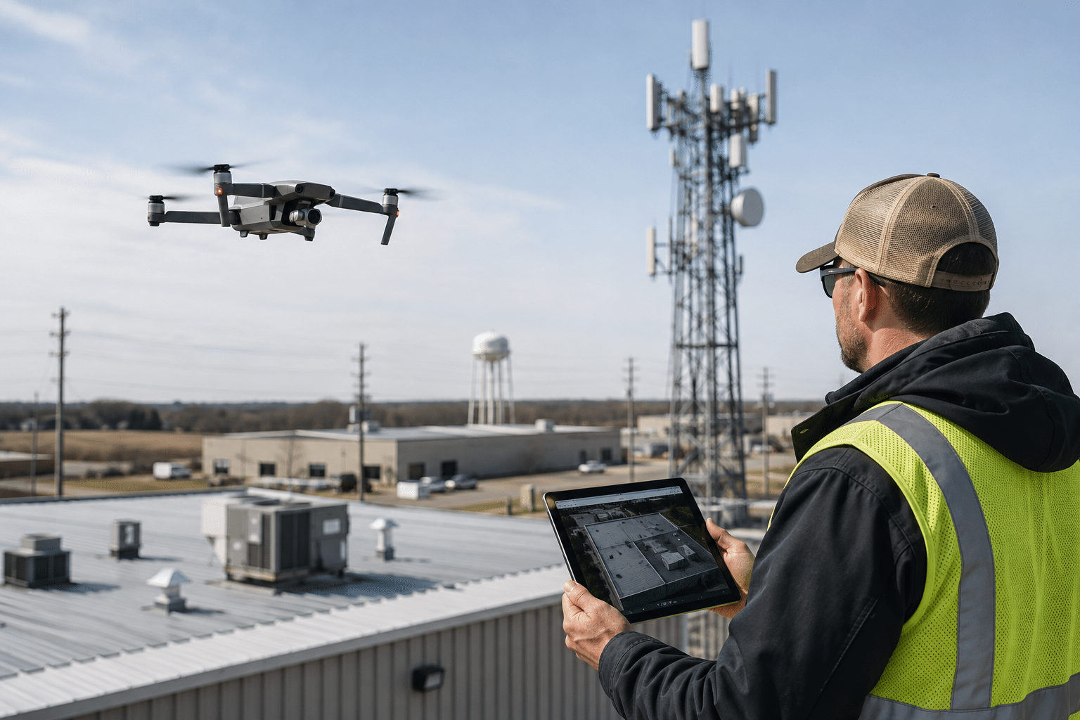
Telecom teams can use recurring drone documentation for towers, compounds, access roads, equipment placement, post-construction condition, and maintenance planning. Drone data helps reduce unnecessary climbs and gives remote stakeholders a clearer view of site conditions.
Facilities teams can use drone inspections to document roof condition, rooftop equipment, drainage areas, facade concerns, storm damage, and maintenance priorities. For portfolio owners, a structured inspection program can help compare sites and prioritize repair budgets.
Construction teams can use drone programs for progress documentation, site logistics, earthwork tracking, material staging, contractor coordination, and owner updates. Recurring aerial data gives project teams a clean record of what changed between milestones.
In agriculture, recurring drone flights can support crop scouting, drainage review, stand assessment, storm damage documentation, and harvest planning. The value is identifying where a ground check should happen first and documenting issues while decisions can still be made.
Solar operators can use drone inspections for thermal anomaly detection, module-level documentation, vegetation review, storm checks, and recurring asset health records. Drone LiDAR and mapping programs can also support corridor review, terrain documentation, vegetation analysis, drainage planning, construction planning, and access assessment.
What Buyers Should Define Before Starting
A good drone inspection program starts with a practical scope. Before scheduling flights, commercial buyers should define what decisions the data needs to support.
Useful questions include:
- What assets need to be inspected?
- What conditions or issues matter most?
- How often does the asset change?
- Who needs the deliverables?
- What format is easiest for the team to use?
- Are there safety, access, airspace, or timing constraints?
- Will the data be compared against prior inspections?
- Does the work require thermal imaging, LiDAR, mapping, or standard RGB photography?
The answers shape the program. A construction progress flight may need frequent site coverage and simple stakeholder visuals. A solar inspection may need specific thermal conditions and detailed anomaly reporting. A telecom site documentation flight may need consistent angles around the tower, compound, access path, and equipment areas.
Trying to use one generic drone package for every need usually produces generic results. A better approach is to match the capture plan to the decision.
What a Strong Deliverable Looks Like
The deliverable should make the buyer’s job easier. That does not always mean more data. Often, it means cleaner data.
A strong commercial drone inspection deliverable may include:
- A concise summary of what was inspected
- Date, site, and flight details
- High-resolution photo or video files
- Location-based issue references
- Annotated images where helpful
- Thermal or LiDAR outputs when included in scope
- A prioritized issue list
- Recommended follow-up areas for the buyer’s team
- Comparison notes from prior inspections
The best deliverable is one that can be forwarded to operations, maintenance, leadership, insurance, engineering, or a contractor without forcing everyone to guess what they are looking at.
How Aero Deploy Approaches Drone Inspection Programs
Aero Deploy helps commercial teams build drone inspection workflows around the actual business problem: safer site visibility, better documentation, and faster decisions.
That can mean a single inspection when a specific issue needs to be documented. But for teams managing multiple assets or recurring maintenance needs, a program approach usually creates more value.
We help define the flight scope, capture requirements, deliverables, and cadence around the use case. That may include agriculture scouting, telecom site documentation, construction progress, roof and exterior inspection, solar inspection, LiDAR mapping, or other operational drone services.
The point is simple: give the right people the right visual data at the right time, in a format they can actually use.
The Bottom Line
Drone inspections are no longer just impressive aerial photos. For commercial teams, they are becoming a repeatable way to understand asset condition, document work, reduce unnecessary site risk, and make better operational decisions.
A one-time flight can be valuable. A well-run drone inspection program can become part of how a company manages its assets.
If your team is responsible for sites, structures, fields, towers, solar assets, construction work, or infrastructure corridors, the next step is not simply asking whether a drone can capture it. The better question is:
What would better recurring visibility help us decide?
Aero Deploy can help answer that question and build the drone inspection program around it.
Contact Aero Deploy to discuss a drone inspection program for your assets, sites, or project portfolio.