The Ground Only Tells Half the Story
I spent 35 years in construction before I started helping build the construction side of Aero Deploy.
That background matters more than the drone.
Anyone can put a camera in the air and come back with good-looking photos. The harder part is knowing what a superintendent, project manager, owner, or developer actually needs to see when the job starts drifting from the plan.
Construction does not usually go sideways all at once. It creeps.
A delivery slips. A crew gets stacked behind another trade. A wet area stays wet longer than expected. Materials get staged in the wrong place. A draw gets questioned because the work is partially complete, but nobody has a clean record of what was done and when.
By the time everyone is arguing about it, the moment that would have settled the argument has already passed.
That is the problem construction drone site documentation is built to solve.
A Site Walk Is Useful. It Is Not a Complete Record.
One of the first objections I hear from general contractors is simple:
“Our supers already walk the site.”
They should. A good superintendent walking the site is still one of the most important parts of running a job. I am not arguing against that.
But a walk is not the same thing as a dated, repeatable, visual record of the full project.
A walk depends on memory, notes, phone photos, and whatever someone had time to capture while they were handling ten other problems. That can work fine when everything is moving smoothly. It gets weaker when money, schedule, or responsibility is being challenged.
A weekly aerial site map gives the team something different. It gives them a consistent view of the whole job, captured from the same perspective, tied to a date.
Now the question is not, “Who remembers what the site looked like?”
The question is, “What does the record show?”
That is a much better conversation.
The $40,000 Lesson
One story has come up a lot in the last few weeks because it makes the point better than any sales pitch.
A project had a draw dispute of roughly $40,000. The argument was over whether enough work had been completed to justify payment. That kind of thing can turn into emails, meetings, delays, and hard feelings fast.
In this case, two dated site maps did most of the talking.
One showed the site before. One showed the site after. The progress was visible. The dispute did not need a week of back-and-forth. It was settled in about 90 seconds.
That is what good documentation does.
It does not make every problem disappear. It does not replace the contract, the schedule, or the people managing the job. But it gives everyone a cleaner starting point.
You can argue with an opinion. You can argue with memory. It is a lot harder to argue with a dated visual record.
Where Construction Teams Lose Time
When people think about job cost, they usually think about labor, material, equipment, and subcontractor pricing.
Those matter, obviously.
But after enough years in construction, you start to see how much money gets burned in the mess around the work. Rework. RFIs. Delay arguments. Pay application friction. Owner questions. Missed documentation. Meetings where half the room is trying to reconstruct what happened two weeks ago.
That is where aerial data can save real time.
Not because the image is impressive. Because the image is useful.
A project manager can use it to defend a schedule update. A superintendent can use it to show access constraints or site logistics. An owner can use it to understand progress without needing to be walked through every corner of the job. A pay application can be supported before the disagreement starts.
The drone is just the capture tool. The value is the record.
What Weekly Aerial Documentation Can Show
The strongest construction drone programs are not built around random photos. They are built around repeatable capture.
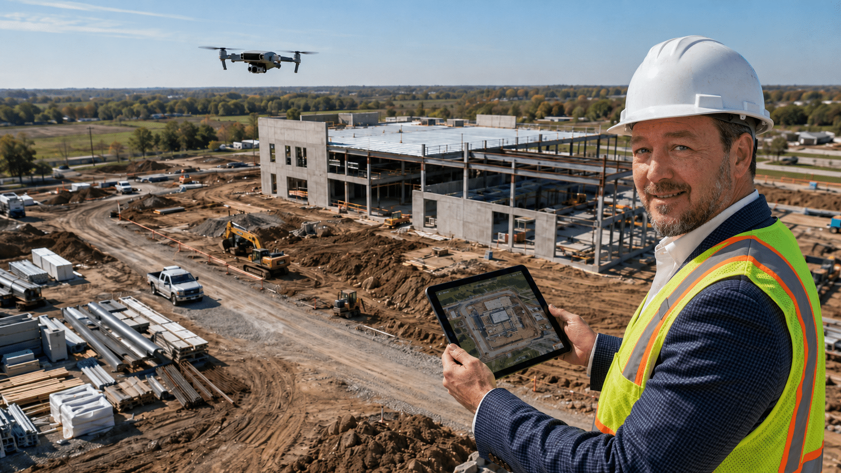
That means the flight is planned around the way the project is being managed. The same areas are captured over time. The same progress zones are visible. The same laydown areas, access paths, structures, staging locations, and work fronts can be compared from one week to the next.
Depending on the site, a construction documentation flight may help show:
- Site progress by area or phase
- Material staging and movement
- Access roads, laydown yards, and logistics constraints
- Earthwork, drainage, grading, or stockpile conditions
- Roof, facade, or exterior progress
- Concrete, steel, framing, utility, or sitework milestones
- Weather impacts and standing water
- Work completed before a pay application
- Conditions before, during, and after a delay event
- Owner-facing progress updates
That does not mean every flight needs a long report. Sometimes the most useful deliverable is a clean aerial map, a handful of dated images, and a short note showing what changed.
Other times, the job needs more structure: annotated images, comparison views, issue callouts, or organized progress logs by area.
The right deliverable depends on the decision the team needs to make.
Pay Applications Need Proof Before There Is a Fight
Pay applications are one of the clearest use cases because the stakes are obvious.
If the owner, lender, or developer questions progress, the contractor needs to show work completed in a way that is easy to understand. Phone photos can help, but they often lack context. They may show a close-up of work, but not where it sits in the broader project. They may show one area well while missing the rest of the site.
Aerial documentation gives pay app support a wider view.
It can show how much of a phase is complete, where materials are staged, what areas have changed, and whether progress matches the story being told in the application.
That does not guarantee every pay app gets approved without questions. Construction has too many moving parts for that. But it gives the team a stronger record before the disagreement starts.
That matters because the best dispute is the one that never turns into a dispute.
Schedule Defense Needs a Timeline
Schedule conversations can get just as messy as payment conversations.
If a project slips, everyone wants to know why. Was it weather? Access? Material? Another trade? Design changes? Owner decisions? Site conditions? Poor sequencing?
Sometimes the answer is obvious. Many times, it is not.
Aerial documentation helps because it creates a timeline. When flights are captured consistently, the team can go back and see what was happening on the site at specific points in time.
That can help a PM explain why a milestone moved, show when an area became available, document when a condition appeared, or demonstrate how site logistics affected production.
Again, it is not magic. It is documentation.
But documentation is what makes a schedule conversation less dependent on memory.
You Do Not Have to Start on Day One
Starting weekly documentation at the beginning of a project is ideal. No question.
But you do not need to wait for the next project.
If a job is already underway and something is already getting sideways, that may be exactly when aerial documentation helps the most.
Maybe the schedule is slipping and nobody agrees why. Maybe a draw is stuck. Maybe the owner wants a clearer progress update. Maybe the site has changed enough that the original logistics plan is no longer useful.
That is not too late.
The first flight gives you a baseline from today. The next flight gives you comparison. From there, the record starts building.
Construction teams make better decisions when they can see the whole site, compare it over time, and point to proof instead of memory.
What a Good Construction Drone Deliverable Should Do
A good deliverable should make the project team’s job easier. It should avoid creating another folder full of files nobody has time to sort through.
For construction, that usually means the deliverable should be:
- Dated and organized by project
- Easy to compare week to week
- Clear enough for a PM, owner, or executive to understand quickly
- Useful for pay applications, schedule updates, or owner meetings
- Stored in a way the team can reference later
- Focused on the actual job questions instead of attractive imagery alone
The best aerial documentation is boring in the right way. It is consistent. It is easy to find. It answers the same question every week:
What changed on the site?
That is the question a construction team keeps coming back to.
Why the Construction Background Matters
I keep coming back to this because it is the part that gets missed when people talk about drones.
The flight matters. Image quality matters. Safety, airspace, equipment, and process all matter.
But the real value comes from understanding the job.
A construction-focused drone program should know why a GC cares about access, sequencing, phasing, laydown space, pay apps, weather impacts, trade stacking, and owner communication. It should know that a pretty overhead image is not enough if it does not help someone make a decision.
That is where my construction background comes in.
I have sat in the meetings. I know what it feels like when the job is moving and everyone is trying to keep the story straight. I know how fast a small documentation gap can become a bigger problem.
Aero Deploy’s construction work is built around that reality. We are not selling photos. We are helping construction teams build a record they can use.
The Bottom Line
The ground only tells half the story.
A site walk tells you what one person saw from one angle at one point in time. Aerial documentation gives the team a broader record they can come back to when the conversation gets difficult.
That record can support pay applications, schedule updates, owner communication, delay conversations, and basic project accountability.
It is not about replacing the people running the job. It is about giving them better proof.
If you are a GC, developer, or owner dealing with schedule slips, pay application friction, or a draw that is stuck right now, you do not have to wait for the next project to bring us in.
Give me 15 minutes. I will take a look at one of your current sites and tell you where aerial documentation could help.
— Todd