AI in the drone industry gets a lot of attention, but most of what you read sounds like science fiction. Here’s what’s actually happening on real job sites right now — and where it’s headed.
We’ve been in the drone services business long enough to watch AI go from a marketing buzzword to something that genuinely changes how we work. Not all of it lives up to the hype, but the parts that do are worth paying attention to.
Automated Object Detection
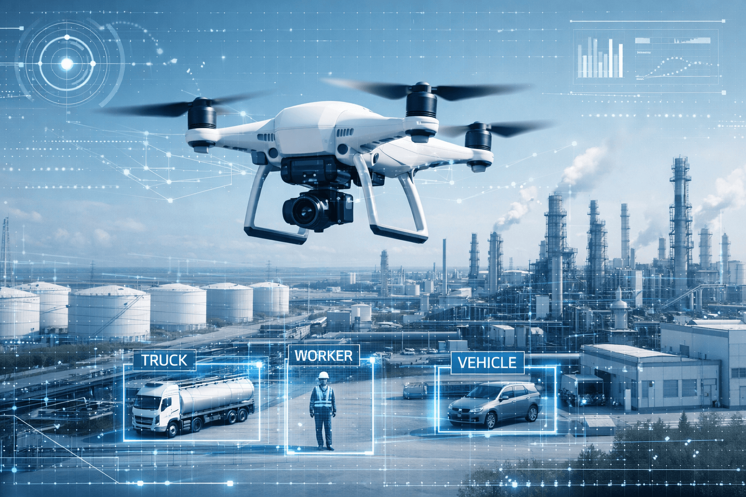
This is the most mature use of AI in the drone industry. Instead of a human reviewing thousands of images frame by frame, computer vision models flag anomalies automatically.
Where it’s working today:
- Cell tower inspections: AI identifies rust, loose hardware, damaged antennas, and missing components from inspection photos. What used to take hours of manual review now takes minutes.
- Solar panel inspections: Thermal imaging combined with AI detects hotspots, microcracks, and underperforming cells across thousands of panels in a single flight.
- Roof inspections: Models trained to identify hail damage, missing shingles, and membrane defects from aerial imagery.
The key word is “flag.” AI doesn’t replace the inspector — it makes sure nothing gets missed. A trained technician still reviews and confirms every finding.
NDVI and Crop Health Analysis
In agriculture, AI in the drone industry is having its biggest impact on day-to-day operations. Raw multispectral data gets turned into actionable recommendations. Instead of handing a farmer a color-coded map and saying “green is good, red is bad,” AI models can now:
- Predict yield estimates based on vegetation index trends
- Identify pest or disease patterns before they’re visible to the naked eye
- Recommend variable-rate application zones for fertilizer and irrigation
- Track crop health changes over time and flag anomalies
We’ve scanned over 4 million acres, and the shift from “here’s your data” to “here’s what your data means” has been the biggest value-add for our ag clients.
Flight Planning and Automation
AI-assisted flight planning is quietly making operations more efficient:
- Terrain following: Drones automatically adjust altitude based on elevation models, keeping consistent ground sampling distance on hilly terrain.
- Obstacle avoidance: Real-time detection and path adjustment around wires, trees, and structures.
- Adaptive mission planning: AI adjusts flight paths based on wind conditions, battery life, and coverage gaps.
- Smart waypoint generation: For complex structures like cell towers, AI can suggest optimal camera angles based on the structure type.
This isn’t flashy, but it reduces flight time, improves data quality, and makes operations safer.
3D Modeling and Photogrammetry
AI has dramatically improved how we process drone imagery into deliverables:
- Faster point cloud generation with fewer artifacts
- Automatic feature extraction from LiDAR data — ground classification, building footprints, vegetation filtering
- Change detection between surveys, useful for construction progress monitoring and stockpile measurement
- Semantic segmentation — automatically labeling what’s in the scene (road, building, vegetation, water)
What used to require expensive software and a GIS specialist is becoming more accessible, though expertise still matters for quality output.
Where AI in the Drone Industry Falls Short (For Now)
Not everything works as advertised:
- Fully autonomous operations are still limited by FAA regulations. Beyond Visual Line of Sight (BVLOS) is coming, but slowly — particularly for utility and transmission line work.
- Generic AI models struggle with industry-specific tasks. A model trained on general images won’t reliably identify a corroded coax connector on a cell tower. Domain-specific training data matters.
- Edge cases are still a problem. AI works great on the 95% of standard scenarios. It’s the unusual situations — odd lighting, unexpected structures, equipment it hasn’t seen before — where human judgment is irreplaceable.
- Data privacy and security are real concerns, especially for infrastructure inspections on telecom and utility assets. Where your data goes and who processes it matters.
What This Means for Drone Service Providers
AI in the drone industry isn’t replacing operators. It’s making good operators more efficient and their deliverables more valuable.
The companies that will thrive are the ones combining flight expertise with smart data processing — not just collecting images, but delivering insights. That’s the shift happening right now.
For clients, the takeaway is simple: ask your drone provider what happens after the flight. If the answer is just “we’ll send you the photos,” you’re leaving value on the table.
Ready to see what AI-powered drone inspections can do for your operation? Contact us to discuss your next project.
Related Reading
- How Drone Cell Tower Inspection Works: A Walkthrough — See AI-assisted inspection in practice.
- NDVI Crop Monitoring with Drones — Deep dive into our agricultural AI applications.
- Drone Inspection Cost vs Traditional Methods — The business case for switching to drone-based inspections.